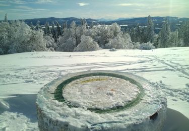
![](/images/other/stat-length.png)
![Tour Wandern La Cluse-et-Mijoux - le grand taureau, la Cluse et Mijoux - Photo](https://media.geolcdn.com/t/1900/400/0cb61e11-ae8c-43af-9765-5d7fbec9633a.jpg&format=pjpeg&maxdim=2)
le grand taureau, la Cluse et Mijoux
eltonnermou
Benutzer
![Länge](/images/other/stat-length.png)
![Maximale Höhe](https://static1.geolcdn.com/siteimages/upload/files/1508320355ic_sort_altitude_max_24dp.png)
![Positive Höhendifferenz](https://static1.geolcdn.com/siteimages/upload/files/1508320355ic_sort_den_pos_24dp.png)
![Km-Effort](/images/other/stat-length.png)
![Min. Höhe](https://static1.geolcdn.com/siteimages/upload/files/1508320355ic_sort_altitude_min_24dp.png)
![Negative Höhendifferenz](https://static1.geolcdn.com/siteimages/upload/files/1508320355ic_sort_den_neg_24dp.png)
![Boucle](https://static1.geolcdn.com/siteimages/upload/files/16400158638029165_repeat_loop_refresh_sync_direction_icon.png)
![Wandern](https://static1.geolcdn.com/sitytour/trail-icons/101.png)
5h26
Schwierigkeit : Medium
![Scannen Sie diesen QR-Code, um die Tour in der SityTrail-Anwendung zu öffnen](https://capi.geolives.com/qq0zvz2zws4bq2lad0pu/sitytour/trails/2526416/qr.png?size=200)
Kostenlosegpshiking-Anwendung
Über SityTrail
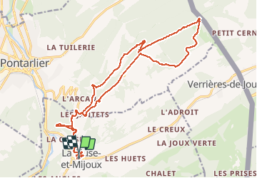
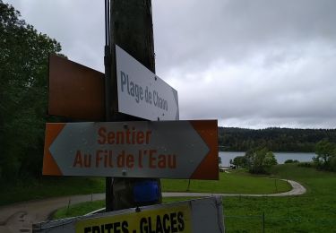
Tour Wandern von 24 km verfügbar auf Burgund und Freigrafschaft, Doubs, La Cluse-et-Mijoux. Diese Tour wird von eltonnermou vorgeschlagen.
Beschreibung
randonnée en groupe
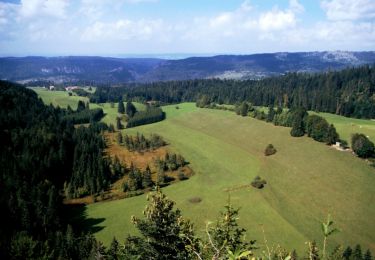
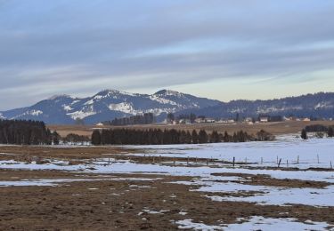
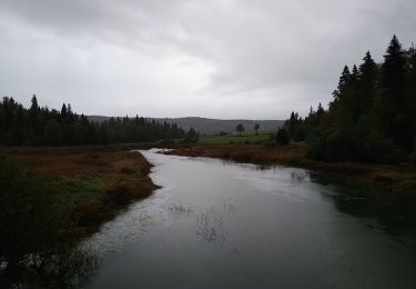
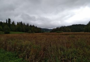
Cette très belle randonnée pédestre vous entrainera à travers différents paysages.
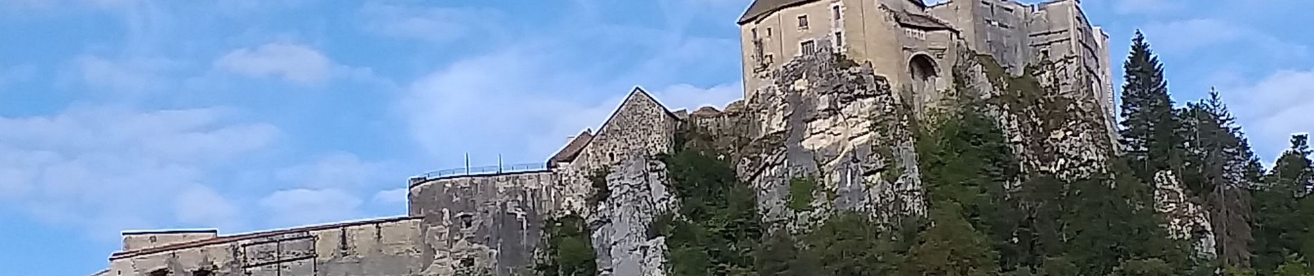
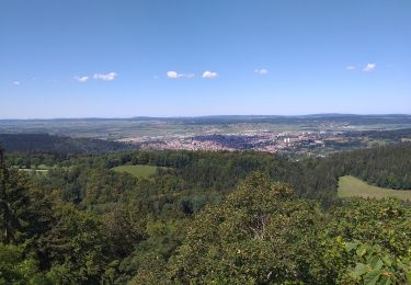
Lors de la montée n'hésitez pas à vous retourner pour admirer le château de Joux (Toussaint Louverture). L'aller retour au belvédère du fer à cheval vaut la peine. Beaucoup de beaux points de vues sur les Alpes, la Suisse, la plaine de Pontarlier.
Avec un peu de chance, vous surprendrez des chamois sur les pentes escarpées du secteur. Vous pourrez apprécier la diversité de la flore (interdite de cueuillette) et profiter d'un parcours ombragé et très agréable.
Vous pouvez sur la fin de parcours profiter du bar à Gounefay.
Ort
Kommentare
Touren in der Umgebung
![Tour Wandern Les Fourgs - Le Stratégique - Doubs - Photo](https://media.geolcdn.com/t/375/260/ext.jpg?maxdim=2&url=https%3A%2F%2Fservices.sitytrail.com%2FGeolivesWS%2FDownloadMedia.ashx%3FTrailID%3D108935%26Media%3D2626_1.jpg)
![Wandern Wandern](https://static1.geolcdn.com/sitytour/trail-icons/101.png)
Wandern
![](/images/other/stat-length.png)
![](https://static1.geolcdn.com/siteimages/upload/files/16400158638029165_repeat_loop_refresh_sync_direction_icon.png)
![Tour Wandern Les Fourgs - 2024-01-31_00h34m12_le-belvedere-de-la-roche-sarrasine_randonnee-2285212 - Photo](https://media.geolcdn.com/t/375/260/ext.jpg?maxdim=2&url=https%3A%2F%2Fstatic1.geolcdn.com%2Fsiteimages%2Fupload%2Ffiles%2F1553511878bg_sport_marche.png)
![Wandern Wandern](https://static1.geolcdn.com/sitytour/trail-icons/101.png)
Wandern
![](/images/other/stat-length.png)
![](https://static1.geolcdn.com/siteimages/upload/files/16400158638029165_repeat_loop_refresh_sync_direction_icon.png)
![Tour Langlaufen Les Fourgs - Piste du Voirnon - Photo](https://media.geolcdn.com/t/375/260/4d46f533-833e-4cab-9d13-d16310de5eba.jpg&format=jpg&maxdim=2)
![Langlaufen Langlaufen](https://static1.geolcdn.com/sitytour/trail-icons/502.png)
Langlaufen
![](/images/other/stat-length.png)
![](https://static1.geolcdn.com/siteimages/upload/files/16400158638029165_repeat_loop_refresh_sync_direction_icon.png)
![Tour Schneeschuhwandern Pontarlier - Pontarlier Gounfay Grand Taureau 2021-01-19 CAF - Photo](https://media.geolcdn.com/t/375/260/6d3d4614-7fee-4759-a4c2-7b058386012d.jpg&format=jpg&maxdim=2)
![Schneeschuhwandern Schneeschuhwandern](https://static1.geolcdn.com/sitytour/trail-icons/504.png)
Schneeschuhwandern
![](/images/other/stat-length.png)
![](https://static1.geolcdn.com/siteimages/upload/files/16400158638029165_repeat_loop_refresh_sync_direction_icon.png)
![Tour Wandern Montperreux - Chaon Saint Point - Lac - Photo](https://media.geolcdn.com/t/375/260/1cb44616-4442-4252-833e-fb8b82bf1bbb.jpg&format=jpg&maxdim=2)
![Wandern Wandern](https://static1.geolcdn.com/sitytour/trail-icons/101.png)
Wandern
![](/images/other/stat-length.png)
![](https://static1.geolcdn.com/siteimages/upload/files/16400158638029165_repeat_loop_refresh_sync_direction_icon.png)
![Tour Wandern Montperreux - Sentier de la découverte - Chaon Malbuisson - Photo](https://media.geolcdn.com/t/375/260/9dad01dd-973e-4ef4-b8da-7f7478c28fff.jpg&format=jpg&maxdim=2)
![Wandern Wandern](https://static1.geolcdn.com/sitytour/trail-icons/101.png)
Wandern
![](/images/other/stat-length.png)
![](https://static1.geolcdn.com/siteimages/upload/files/16400158638029165_repeat_loop_refresh_sync_direction_icon.png)
![Tour Wandern Montperreux - La Gouille - Photo](https://media.geolcdn.com/t/375/260/85cd76c8-b938-42d3-aec6-148fb2329c9a.jpg&format=jpg&maxdim=2)
![Wandern Wandern](https://static1.geolcdn.com/sitytour/trail-icons/101.png)
Wandern
![](/images/other/stat-length.png)
![](https://static1.geolcdn.com/siteimages/upload/files/16400158638029165_repeat_loop_refresh_sync_direction_icon.png)
![Tour Wandern Montperreux - La source bleue - Photo](https://media.geolcdn.com/t/375/260/8f4113b6-be86-421b-922f-6c8f51836eb0.jpg&format=jpg&maxdim=2)
![Wandern Wandern](https://static1.geolcdn.com/sitytour/trail-icons/101.png)
Wandern
![](/images/other/stat-length.png)
![](https://static1.geolcdn.com/siteimages/upload/files/16400158638029165_repeat_loop_refresh_sync_direction_icon.png)
![Tour Wandern Pontarlier - le grand taureau, Pontarlier - Photo](https://media.geolcdn.com/t/375/260/d15871e2-3d8a-47b8-b9b7-cb07d343a2f0.jpg&format=jpg&maxdim=2)
![Wandern Wandern](https://static1.geolcdn.com/sitytour/trail-icons/101.png)
Wandern
![](/images/other/stat-length.png)
![](https://static1.geolcdn.com/siteimages/upload/files/16400158638029165_repeat_loop_refresh_sync_direction_icon.png)